If you are looking at Bel Air land, lot size alone will not tell you much about redevelopment potential. In 90077, a parcel’s upside often depends on a more technical mix of zoning, hillside overlays, slope, access, grading limits, and utility conditions. When you understand those factors early, you can screen opportunities more intelligently and avoid costly surprises. Let’s dive in.
Why redevelopment in Bel Air is different
Bel Air sits within the Bel Air-Beverly Crest Community Plan, which frames the area as predominantly single-family with limited commercial and multifamily pockets. The plan favors preservation of low-density residential areas and open land. It also states that more intensive land-use changes should be justified in the public interest.
For you as a buyer, owner, or land investor, that means redevelopment potential is shaped by context as much as by parcel dimensions. In practical terms, sites that can maintain the area’s low-density hillside character may align more closely with the plan than projects that depend on major grading, major visual change, or significant street modifications.
Start with parcel-level screening
Your first public research stop should be ZIMAS. The city identifies ZIMAS as the source for parcel-level zoning, land-use designations, permit history, and overlay information, and you can search by address, APN, or case number.
This is where you begin to answer the most basic feasibility questions. You are not just confirming zoning. You are also checking whether the parcel is in a hillside area, whether specific overlays apply, and whether there is prior entitlement or permit activity that could affect your underwriting.
What to check in ZIMAS
When screening a Bel Air land parcel, focus on these items first:
- Base zoning and land-use designation
- Permit history and planning case activity
- Hillside Area status
- Any applicable specific plan overlays
- Street and access context shown in public records
City Planning notes that the Original Zoning Code applies to most of Los Angeles outside Downtown, including this area. That matters because your review process should follow the rules that actually govern the parcel rather than assumptions based on newer code frameworks.
Baseline Hillside Ordinance matters
For many Bel Air single-family sites, the Baseline Hillside Ordinance guide is one of the most important documents in early due diligence. City Planning says it applies to certain residential zones in designated Hillside Areas, including R1, RS, RE, and RA parcels shown on the city’s Hillside Area Map.
A key point here is that you should confirm the Hillside Area (Zoning Code) field in ZIMAS. The city specifically notes that an H suffix alone does not prove the ordinance applies. That small distinction can save you from making the wrong assumptions about development standards.
Why this overlay changes feasibility
The Baseline Hillside Ordinance can affect site design, setbacks, parking, and utility requirements. It also ties redevelopment potential more closely to real site conditions, especially on parcels with slope or access constraints.
One practical example is sewer infrastructure. According to the city guide, a new one-family dwelling within 200 feet of a sewer mainline generally cannot receive a building permit unless a sewer connection is provided to the satisfaction of the City Engineer. For some parcels, that can become a real cost and timeline factor.
Mulholland and hillside regulations can add complexity
Some parcels in Bel Air also fall within the Mulholland Scenic Parkway Specific Plan area. City Planning lists this as an overlay affecting part of the Bel Air-Beverly Crest Community Plan Area, with its own regulations, design standards, maps, and filing instructions.
If your lot is within that specific plan area, you should expect another layer of review. That does not automatically eliminate redevelopment potential, but it can narrow design flexibility and increase the importance of early planning analysis.
Bel Air-Beverly Crest is also subject to Hillside Construction Regulations in applicable areas. The city says these rules were created to address steep topography, substandard roads, and fire severity risk.
Key HCR thresholds to know
According to the city FAQ, HCR can include:
- Maximum grading of 6,000 cubic yards on typical sites
- Maximum grading of 4,500 cubic yards on substandard streets
- Haul trips capped at four per hour
- Construction hours generally limited to Monday through Friday, 8 a.m. to 6 p.m., with Saturday interior work only
- Site Plan Review for houses larger than 17,500 square feet
For investors, those numbers matter because they affect construction logistics, cost, schedule, and design scope. A parcel may appear attractive on paper but become less flexible if the grading program or haul route assumptions do not fit within these limits.
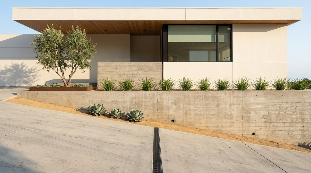
Slope is not just a design issue
In Bel Air, slope is part of the planning framework itself. The community plan states that hillside land-use intensity should be limited by factors such as street circulation, sewer availability, drainage, fire protection, hillside regulations, and the steepness of natural topography.
That is why two parcels with similar square footage can have very different redevelopment profiles. A gentler site may allow broader design options, while a steeper site may require more engineering, more grading analysis, and a narrower path to approval.
The same plan also encourages cluster-style development in hillside areas, with development concentrated on more level terrain and more land left in a natural or park-like state. Even if you are evaluating a single parcel rather than a larger development concept, the planning direction is clear: topography is central to how the site should be approached.
Access can make or break a project
In Bel Air, access deserves as much attention as slope. The community plan links hillside intensity to circulation and road conditions, and it also says that existing streets should not be widened, realigned, or improved in ways that increase traffic capacity if that would conflict with community character.
This can become especially important on parcels served by narrower hillside streets. Under the Baseline Hillside Ordinance guide, a substandard hillside limited street is a public or private street under 36 feet wide with a paved roadway under 28 feet wide.
What substandard street access can trigger
Lots on substandard hillside limited streets may face:
- A 5-foot front yard setback standard
- Street dedication requirements
- Added parking rules
- Fire-protection provisions
Those are not small details. They can affect building envelope, site planning, and whether a redevelopment concept remains efficient after engineering and design constraints are applied.
Grading is a core feasibility test
In hillside Bel Air, grading is often one of the first serious filters between a promising parcel and a difficult one. LADBS states that grading permits are required for grading or earthwork in the Hillside Grading Area, as well as for removal and recompaction or backfill.
The department also notes that soils or geology reports are usually required before permits are issued. Grading plan checks may also be required for slope repairs, landslide repairs, mass grading, hillside basement excavation, hillside pool excavation, and retaining-wall cuts or backfill.
For you, the takeaway is simple: do not evaluate a Bel Air lot based only on a conceptual build size. A realistic feasibility review should also account for whether the site’s grading, retaining, soils, and geology demands are manageable within the regulatory framework.
A smarter public-record workflow
Before you spend heavily on design, you can do a meaningful first-pass review through public sources. A useful workflow is to start with ZIMAS, then review the community plan map, then look at planning case records and permit history, and then confirm grading or access-related requirements through City Planning, BOE, and LADBS.
City Planning also offers the Universal Planning Review Service, which applies in hillside areas subject to the Baseline Hillside Ordinance map. The city notes that new construction and additions may require a Bureau of Engineering Preliminary Land Use Report.
LADBS also maintains online building records for permits, plans, inspections, and code-enforcement records. Together, these sources can help you identify whether a parcel has hidden friction before you move too far into acquisition or design.
Build the consultant team early
In Bel Air, redevelopment analysis usually works best when you bring in technical advisors before a design is finalized. Based on the city’s planning and permitting framework, the most relevant professionals often include:
- Land-use planner
- Civil engineer
- Geotechnical engineer or engineering geologist
- Surveyor
- Architect
- Arborist, when needed
- Transportation or haul-route consultant, when needed
This early team approach is especially useful when you are evaluating steep sites, limited-street access, or lots with potential overlay conflicts. It helps you test what is actually buildable instead of what looks possible in a basic spreadsheet model.
What usually signals stronger redevelopment potential
In Bel Air, parcels with stronger redevelopment potential often share a few traits. They tend to have gentler slope, more standard street access, lower anticipated grading demand, and fewer overlay conflicts.
That does not mean a more difficult parcel lacks value. It means the path is usually more specialized. A steep or access-constrained lot may still be a strategic opportunity, but it is more likely to require careful entitlement review, engineering coordination, and a longer planning timeline.
If you are evaluating Bel Air land for redevelopment, the goal is not just to find a large parcel. It is to find a parcel where zoning, topography, access, and construction logistics work together in a realistic way. That is where informed underwriting can create an edge.
When you want a discreet, development-informed perspective on land or estate opportunities in Bel Air, Amir Jawaherian offers private advisory tailored to complex hillside and legacy-neighborhood transactions.
FAQs
What is the first step for evaluating Bel Air land redevelopment potential?
- Start with ZIMAS to review parcel-level zoning, land-use designation, permit history, and overlay information.
How does the Bel Air-Beverly Crest Community Plan affect redevelopment?
- The community plan emphasizes low-density, predominantly single-family development and preservation of open land, which can limit support for more intensive land-use change.
How do hillside overlays affect a 90077 parcel?
- Hillside overlays can affect setbacks, grading, access standards, parking rules, sewer requirements, and the overall flexibility of a redevelopment concept.
What is a substandard hillside limited street in Bel Air?
- Under the Baseline Hillside Ordinance guide, it is a public or private street under 36 feet wide with a paved roadway under 28 feet wide.
Why is grading so important for Bel Air redevelopment feasibility?
- Grading can trigger permits, plan checks, and soils or geology report requirements, and HCR may limit grading volume and haul activity, which directly affects cost and design scope.
When should you bring in consultants for a Bel Air land project?
- It is usually best to assemble your planner, engineer, surveyor, architect, and other specialists early, before design assumptions are finalized.